This is an interesting and valuable activity which developed out of a conversation with one of the TOs and was subsequently taken up by Matthew Dhulumburrk and other Elders. The name translates roughly as ‘Land Kinship Mapping’ and can be illustrated by the map for the Ramingining township area.
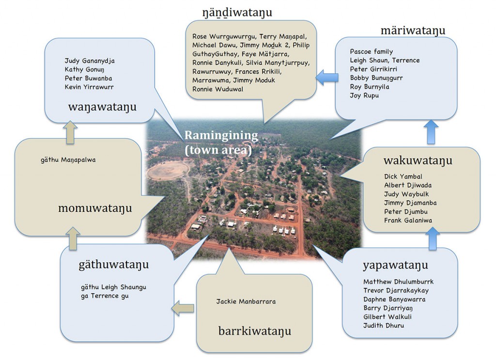
The activity shown itself to be particularly valuable to Yolŋu as it is a way (albeit 2D and lacking the dynamic richness of the complex relationships continually being re-enacted in Yolŋu society), of illustrating that the simple notion of one group of ‘Land Owners’ or TOs, is just plain wrong, and is even offensive to Yolŋu.
The maps show that for any particular estate, while there is a clan who has inherited that land from their father (and are know as the wäŋawataŋu = land owners) there are also clans which call that land their mother (ŋäṉḏi), grandmother (märi), etc. They in turn are the ŋäṉḏiwataŋu (the owners who call the land ŋäṉḏi/mother), märiwataŋu (owners who call the land märi/granmother), etc.